The Move, a ‘transportation solutions start-up’ based in Udaipur, India brings forth ‘Riyadh Trip Survey’ App.
This is time to make Riyadh the Smart City. The residents of Riyadh are encouraged to contribute in making Riyadh the smart city by using this app. They are invited to participate in the trip survey and provide their trip details. The app makes use of the residents of Riyadh trip data to study travel behaviour, travel pattern and chosen routes. The city can be made smart by redistribution of routes, time separation of peak flows, and provision of one-way roads.
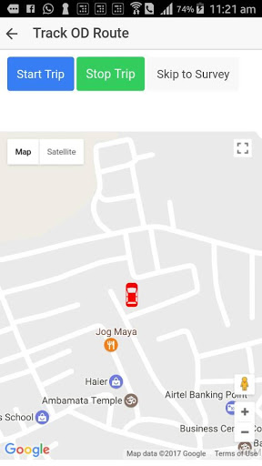
The residents of Riyadh, while participating in the trip survey on an appointed day and time, use the app to record the details of the trips being made. The app will track the path used by the trip maker and record the trip path coordinates and speed details using the mobile GPS device or other. After the completion of the trip, the trip makers are requested to participate in the survey. As a participant of the survey, the users must provide the following information related to the trip recently completed:
1. Name
2. Occupation
3. Mode of trip
4. Purpose of trip
5. Occupancy of vehicle during trip
6. Origin of trip
7. Destination of trip
8. Number of trips made in day
9. Number of trips made in week
10. School name, class, bus no; if school student
11. College name, class, bus no; if college student
12. Office name; if working
The trip data may be used to create the detailed travel demand model catering to all demand strata: students, employees, businessman, recreation trip makers, shopping trip makers etc. The future transportation planning of the city can be accomplished with appropriate statistical size and the detailed trip data.
The trips data could be analysed and processed to achieve the following:
1. to evaluate travel behaviour of Riyadh
2. to develop travel demand model of Riyadh
3. to study the routes chosen and present the following:
a. reallocation or spatial separation of routes to the schools, colleges or other big institutions that have high trip attractions
b. time separation of traffic flows by suggesting different timings of the institutions so that congestion is diluted and spread over time
c. rendering certain roads as one-way permanently or for certain period of time
4. to identify travel problems and propose alternate mitigation solutions to the problems
Since the GPS will be used to collect the data continuously, the users must sufficiently charge the phone before the trip.
Many thanks to Riyadh residents for their contribution towards making their hometown a SMART CITY.
 blackberry Priv


